Baragolai Fm
Type Locality and Naming
Named after Baragolai colliery. Type section is in the Baragolai colliery adjacent to Namdang river section. [Original Publication: Evans P. 1932. Tertiary succession in Assam, Trans. Min. Geol. Inst., India, vol. 27, pp. 155.]
Reference well: Dikhu river section.
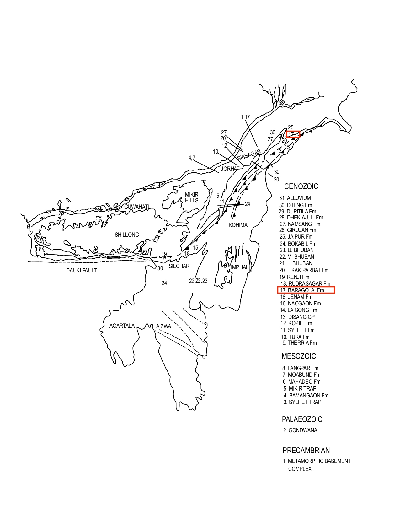
[Figure 1: Formation stratotypes of North East Basins (modified after Pandey and Dave, 1998)
Synonyms: Redefined by Deshpande et al., 1993: The Coal Measures of Mallet (1876) were separated into Baragolai and Tikak Parbat stages by Evans (1932) on the basis of thickness and persistence of coal seams in the upper part.
Lithology and Thickness
Sandy claystone. Type section lithology: It consists of interbedded shale, sandy shale thin sandstones and coal. It is followed by interbedded sequence of thin-bedded sandstones, sandy shales, carbonaceous shales and coal. Near the top a predominantly sandy sequence with thin interbeds of sandy shales or mudstones is present. Reference section lithology: In the reference section of Dikhu river in Naga hills, sandstones interbedded and alternating shales, carbonaceous shale and coal constitute the formation. Thickness is approximaterly 2700 m which gradually thins towards northeast and southwest, (Deshpande et al., 1993).
Relationships and Distribution
Lower contact
It overlies the Naogaon Fm conformably
Upper contact
Conformable upper contact with Tikak Parbat Fm.
Regional extent
It is exposed from Sadiya frontier in the northeast to Mokochung in the south-west. The formation is fairly mappable unit in the Schuppen belt, (Pandey and Dave, 1998).
GeoJSON
Fossils
Arenaceous Foraminifera viz., Trochammina sp., Haplophragmoides sp., are reported.
Age
Depositional setting
Deltaic Environment (Deshpande et al., 1993).
Additional Information
